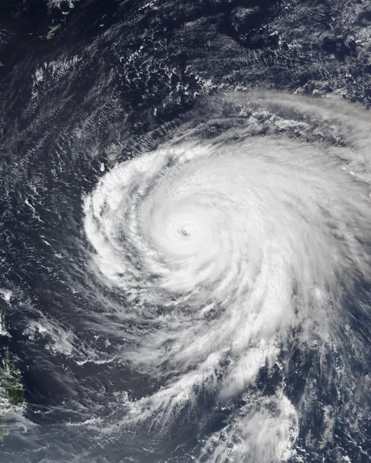

A powerful western Pacific storm has prompted warnings in Taiwan and nearby Japanese islands. Forecast tracks and travel impacts need ongoing checks.
A storm track is not the whole story
Typhoon Champi has put Taiwan and Japan’s southwestern islands on heightened watch. On October 21, Weathernews cited Japanese weather-agency observations indicating sustained winds around 215 km/h and central pressure near 900 hPa at a particularly intense stage. Those measurements refer to a specific observation time; they should not be mistaken for the storm’s current intensity whenever an article is read.
Reuters reported a land warning in Taiwan ahead of the expected approach. Airlines and passengers face disruption from strong winds, heavy rain, rough seas and operational restrictions. A particular cancellation, however, must be checked with the airline or airport rather than inferred from a broad storm map.
What travellers and residents should check
Taiwan’s Central Weather Administration, Japan’s Meteorological Agency and local emergency services remain the relevant sources for warning areas and timing. Forecast paths carry uncertainty. A change in direction or strength can substantially shift the danger faced by coastal communities.
People in warned areas should monitor local instructions, avoid exposed shorelines and be wary of old track screenshots circulating without timestamps. Wind is only one hazard: surge, heavy rainfall, flooding and landslides can occur beyond the narrow line marking a cyclone’s centre.
The satellite-image caveat
The proposed image records Champi on October 20, 2026. Its caption must say so; it is documentary imagery, not a live satellite feed. Any public release of this article requires a last check of the official forecast.
Sources and documents
Editorial verification: based on reporting available October 22, 2026. Recheck developments before release.