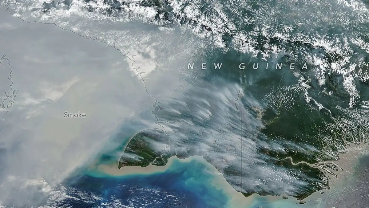

NASA Earth Observatory published satellite imagery showing widespread smoke from fires in New Guinea during a severe dry spell. Its October 22 analysis connects unusually high fire emissions to drought conditions and El Niño-related shifts in rainfall. The image was acquired on October 11, not on the article’s publication date.
What the satellite detected
New Guinea spans Papua New Guinea and Indonesian territory. Reported emissions need to be assigned to the correct side of the island, while burned area and carbon released are entirely different measurements.
When the image was captured
NASA explains that land-management fires can spread in exceptional drought. Smoke then affects visibility and air quality, with consequences for transport, schools and public health. Any NASA imagery needs full source credits and must not imply agency endorsement of ViBytes Tools.
What imagery alone cannot prove
The monitoring system combines detected fire activity with emissions models, so carbon totals are data-based estimates, not measurements taken at every flame. NASA describes exceptional conditions on both sides of the island. A long drought does not give every fire the same cause or establish legal responsibility for any particular blaze.